Strava Heat Map ~ Summer 2013

A morning in the life of...
One Saturday, at the end of July 2013, Strava decided to log
every single ride in the world. From which, they produced a heat map of activity,
with the luminescence of the blue line signifying the depth of traffic density.
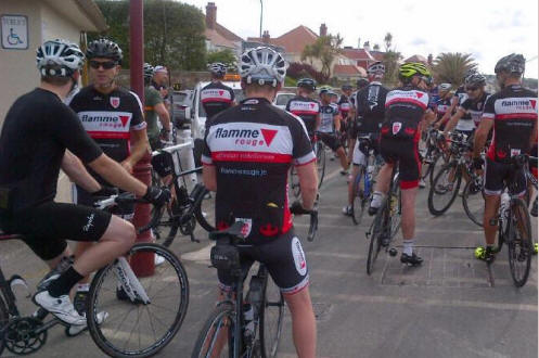
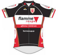
Well here's Jersey's contribution. And as you can see, as ever, Equipe flamme rouge took the lead.
Here's how our morning unfolded...

The calm before the storm ~ everyone talking tactics, nutrition and
the upcoming football season which Liverpool FC could well
dominate...
Run up to 8:30 am
The flamme rouge
Gunsite
Grupetto gather at the bottom centre of the island, at
our meeting point for the last ten years, St Aubin's Gunsite Cafe.

You can see a few early morning riders out to the west of the island, but the main gathering is heading towards the Gunsite.
To put the ride in to perspective, The south of the island sits at sea level, the north has 100 meter high cliffs. Everything else is in between. Jersey is nine miles wide and five miles tall. On a good day, it takes around an hour and twenty minutes to do a lap.
The Prologue 08:30 ~ 09:00
Having grouped,
groped and gathered, we run a quick safety briefing. The
"senior riders" amongst us, use this briefing opportunity to take a pre-ride, safety, comfort break
at the cafe facilities. With the admin sorted, it's a quick head count,
then leave at 8:30 prompt.
A little shimmy to the right and we turn in to St Peter's Valley for a warm-up before we head onwards and upwards for the north of the island.


St Peter's Valley Landmarks
Jersey's top Gastro Pub The "Vic in the Valley" and our indigenous bovines
Once at the top of the island (in both senses) we drop back a little to head for Val de la Mar and the road to Mont Mathieu which descends to the dramatic west coast, where we can see, on the horizon, our neighbours in Guernsey.

We regroup, admire the view, and eat and drink on the flat, to get ourselves ready for the next segment. A combination of climbing and speed, but for some, not necessarily both at the same time.
The Softening Up ~ 09:00 ~ 10:00

Here, we blast up Battle of Flowers Hill, and on to the north west Bal Tab Circuit before we cut back to the centre of the island, passing the windmill and heading for Carrefour Selous; which is the crossroads situated at the dip of the "V" in the centre of the map.

From there we turn north again to head for the Les Platons headland at the rock's, top dead centre.
The Killer Blow 10:00 ~ 11:00

The glorious Les Platons Headland
Coming off Les Platons we continue east, to tackle the Hougue Bie Circuit before dropping to the north east coast and the harbour (below) of the mighty (it's a relative term) Rozel Climb!


Once out of the bay, we regroup stragglers (me!) then head west again to the centre of the island.
Once there we all do a "Red Arrows Burst" to return home. We don't do coffee stops. Busy lives, busy people, infections to avoid etc..

The flamme
rouge juggermaught thunders across the
top of the island
to return to their long-suffering, patiently-waiting, families (who writes this stuff?)
The Slow Road Home ~ 11:30
And as I'm on my own you can just make the thin blue line
heading back to flamme rouge
service corse at the foot of the beautiful Grands Vaux Reservoir,
the place I call home...


My very own water feature and dog walk
always a welcome sight after a morning's battering
So there we are. Forty odd riders, around 80k, just under three hours, with goodness knows how many junctions, corners, hills and segments and no one dropped. Why not come and join us sometime?
Here's our full ride...

And here's the Strava Heat Map. Just zoom out to find your playground of choice. It's a fascinating glimpse in to the weekend habits of cyclists around the world. You've gotta love it...


